Econometric analysis with spatial data
At Oxford Scientia, my geospatial start-up with Argemiro Rivera, we produce prediction applications combining spatial data with econometrics:
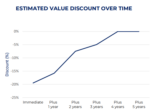
Value at Risk (Flooding) estimates the immediate house-price discount from an inundation, and the subsequent tapering (Graph).
Urban Lens reports the probability of a neighbourhood undergoing rapid change in the coming 3/5/10 years.
Front Runner estimates the probability of a particular retail chain appearing in any given English neighbourhood.
DEMAND FORECASTING
For an international commodities major, I developed a steel-demand forecast model based in part on geospatial analysis of building heights, using Global Human Settlement Layer geospatial datasets.

More details of my geospatial work are listed on my LinkedIn page.